Wayfinding in Vancouver
Stakeholders:
City of Vancouver
Vancouver Park Board
City of Vancouver Archives
Projects:
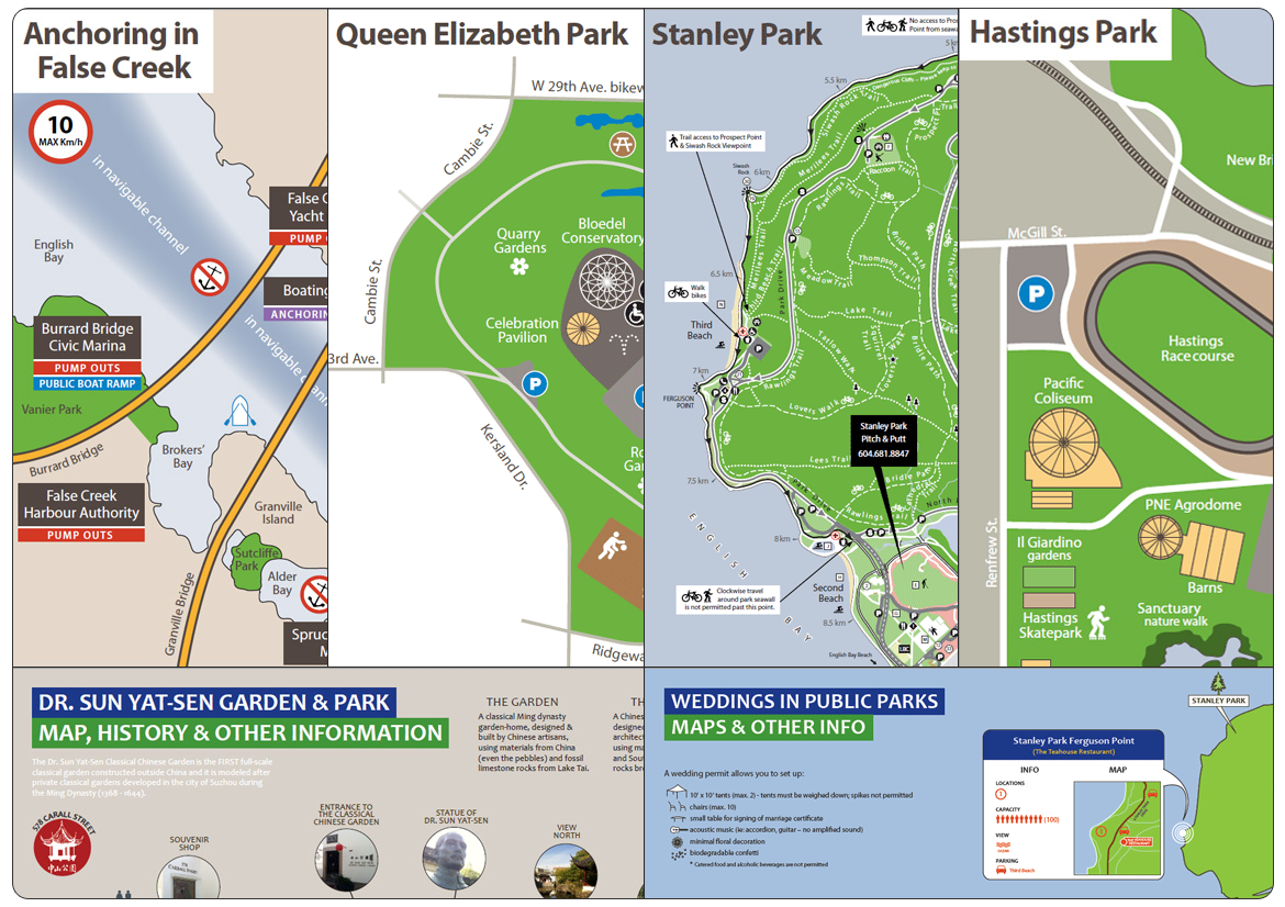
Stanley Park MAP
Queen Elizabeth Park MAP
Anchoring in False Creek MAP
Weddings in Public Parks MAP
The Vancouver Seawall MAP & Timeline
Hastings Park and Pacific National Exhibition Map
Dr. Sun Yat-Sen Classical Chinese Garden and Park MAP
City Hall Campus MAP (Interactive)
Archives Reading Room MAP
Britannia Centre MAP
Affordable Housing Locations MAP (Interactive)
Garbage collection
VAN MAP
Timeline:
August 2011 - December 2012
Disciplines:
Artwork production
Digital mapping
Iconography
Mapping design
User experience
User interface
Tools:
Pen & paper
Adobe Illustrator
Adobe Photoshop
Wacom Intuos Tablet
Description
While working at the City of Vancouver as a Visual Content Strategist / Infographics Specialist, I was approached by various business units within the City to develop a coherent look and feel for the maps displayed online, as well as the printed ones. This was a big undertaking, for a number or reasons:
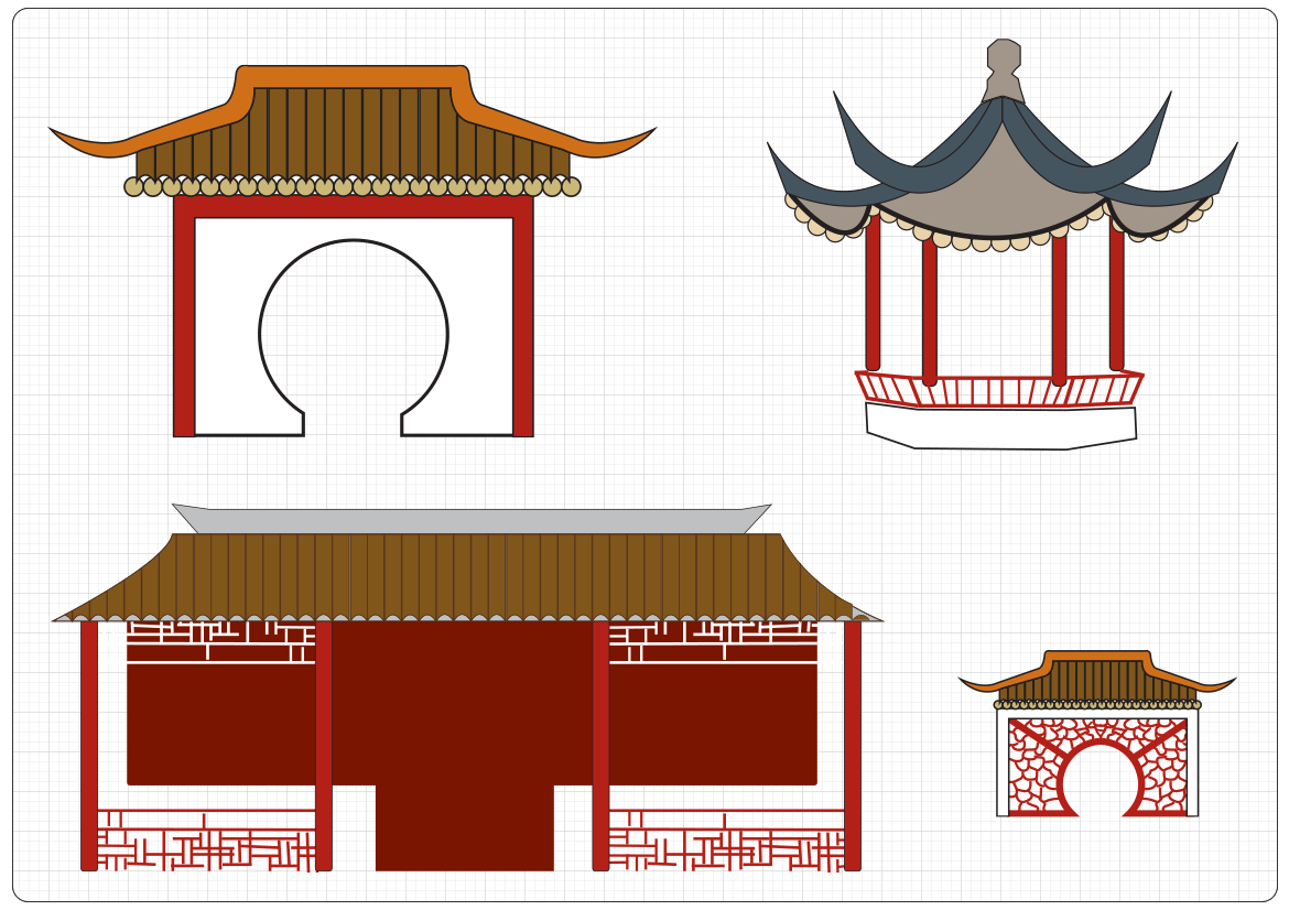
1) Most maps had to be designed from scratch, without as much as a rough sketch to use as a starting point. For example, in the case of Dr. Sun Yat-Sen Classical Chinese Garden and Park MAP, I had to spend a full day surveying the garden, drawing on paper the shape of the lotus ponds, the position of the bridges and the pavilions, while making sure to make a distinction and marking the "border" between the garden (paid entry) and the park (free of charge). I also took lots of photos, which later I had to carefully trace in Illustrator, to create all the elements (the intricate gates and pavilions).
2) The existing, printable map of Stanley Park had to be simplified and optimized for web, while making sure the online PDF provided was still perfectly legible when printed and optimized for search engines.
3) Other maps not only had to be designed from scratch, but also had to be interactive, as is the case of City Hall Campus, Affordable Housing Locations, etc maps.
4) In the case of the interactive garbage collection map, the main challenge was to accurately display the collection areas of Vancouver without confusing the citizens, as the garbage department divided its collection areas slightly different than the how they have been historically known, and the borders were slightly different for each area.
5) Last but not least, all maps had to adhere to a coherent look and feel, without compromising the design of existing, printable ones.
Process
In the case of Queen Elizabeth Park, Hastings Park and Pacific National Exhibition, Anchoring in False Creek, Weddings in Public Parks, The Vancouver Seawall and the Dr. Sun Yat-Sen Classical Chinese Garden and Park projects, the mandate was clear: design printable maps from scratch, for the purpose of displaying them online while also providing a link to a printable PDF.
The first step in the process was to perform an audit of existing resources and data. To accurately do this, I regularly met with and worked closely with representatives from the Web Redevelopment Project, Communications Department, Vancouver Park Board, the Engineering Department and VAN MAP.
As mentioned before, in the case of Dr. Sun Yat-Sen Classical Chinese Garden and Park MAP, I had to spend a full day surveying the garden, drawing on paper the shape of the lotus ponds, the position of the bridges and the pavilions, while making sure to make a distinction and marking the "border" between the garden (paid entry) and the park (free of charge). I also took lots of photos, which later I had to carefully trace in Illustrator, to create all the elements (the intricate gates and pavilions).
For the Queen Elizabeth, Hastings and PNE, False Creek, Weddings in Public Parks and The Vancouver Seawall maps I used aerial photos and screenshots as a starting point, combined with trips to each location/area, to further fine-tune the details of each place.
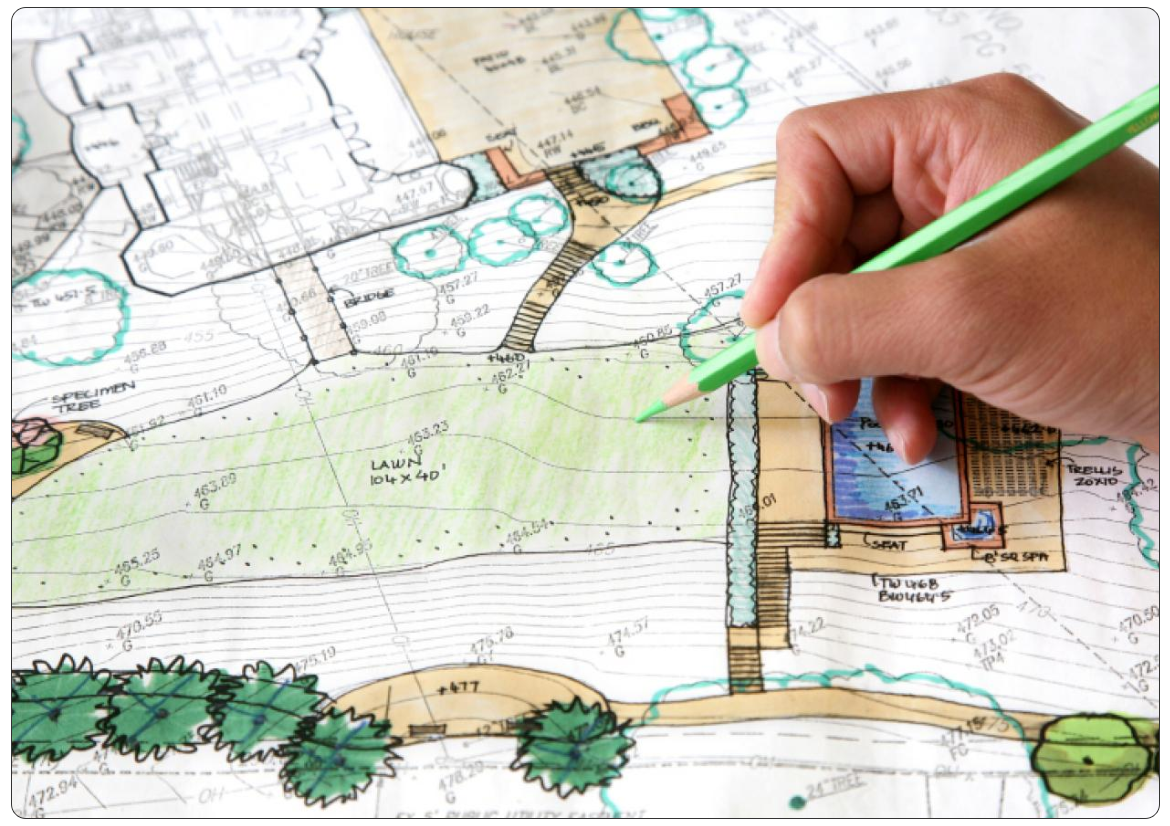
Once I had a collection of hand-drawn maps in my sketch book, and after confirming with each stakeholder that enough data points have been collected for an accurate representation of each map, I used Adobe Illustrator and Photoshop for software and the Wacom Intuos tablet as hardware to draw, trace and delineate the details.
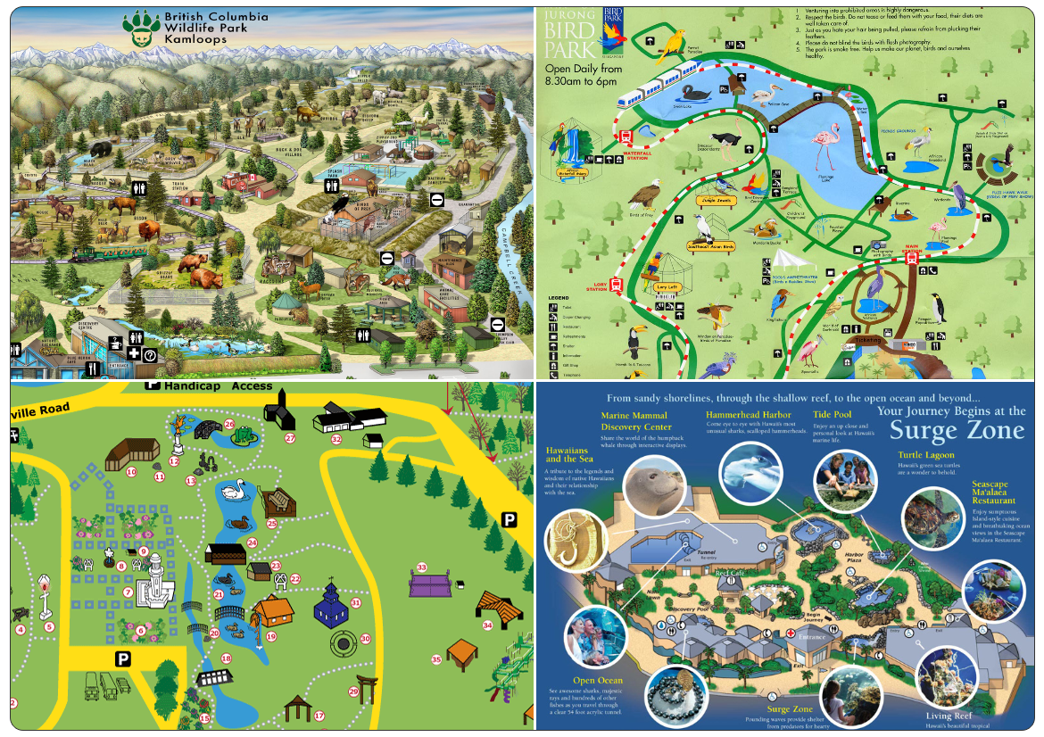
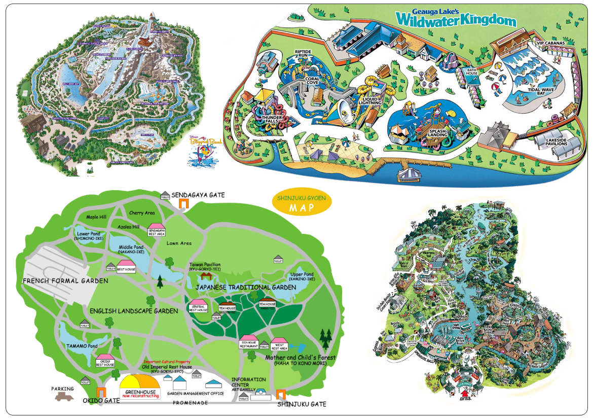
Stanley Park Map - Inspiration Board
Below is a collection of maps used as an inspiration in deciding which direction to go. As mentioned before, the style for the maps had to match the new design of the City of Vancouver website, while integrating elements from the existing (printed) maps, as was the case with the Stanley Park brochure.
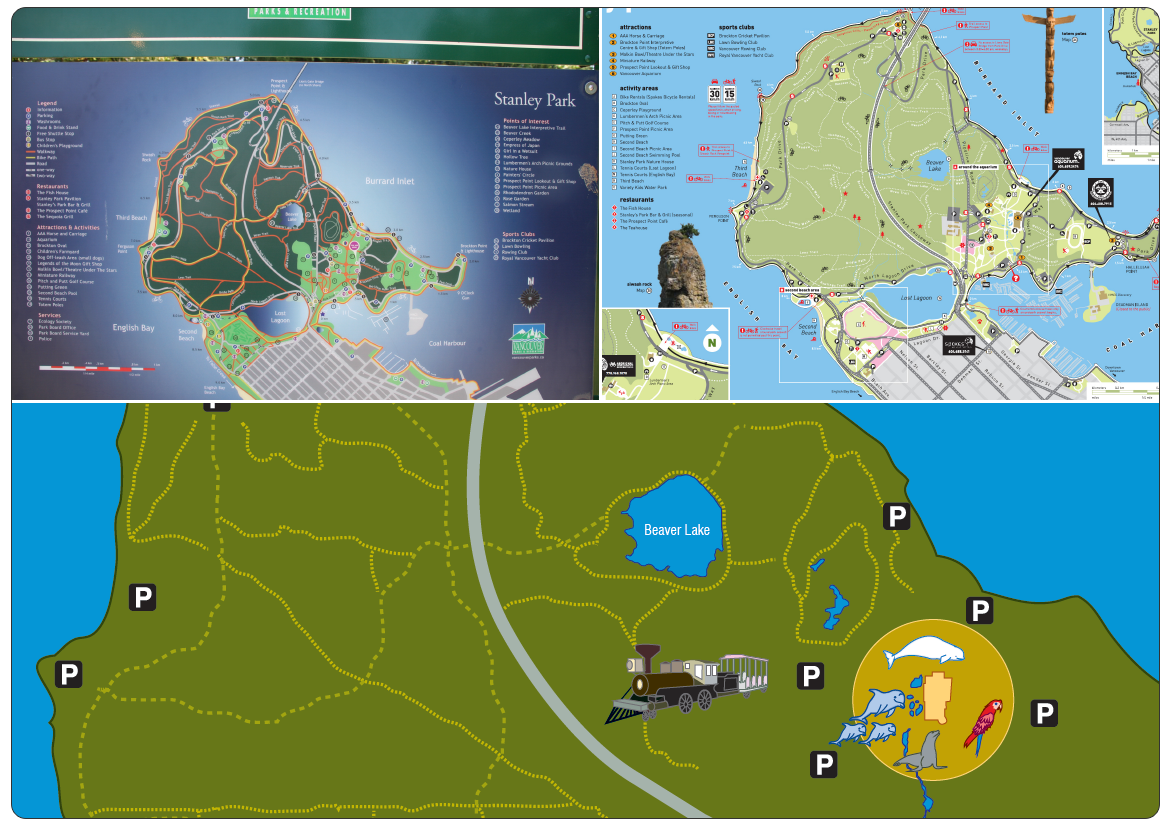
Stanley Park Map - Research
A lot of consideration went into trying to merge elements from the old maps, like the one on the left (which is from a sign in the actual park), or the brochure to the right (which contained tons of details). Upon conducting interviews, it became clear that a newer, simpler map was needed, one that highlighted the main trails, the Vancouver Aquarium and the Stanley Park Railway, and the Seawall.
Stanley Park Map - Illustrations
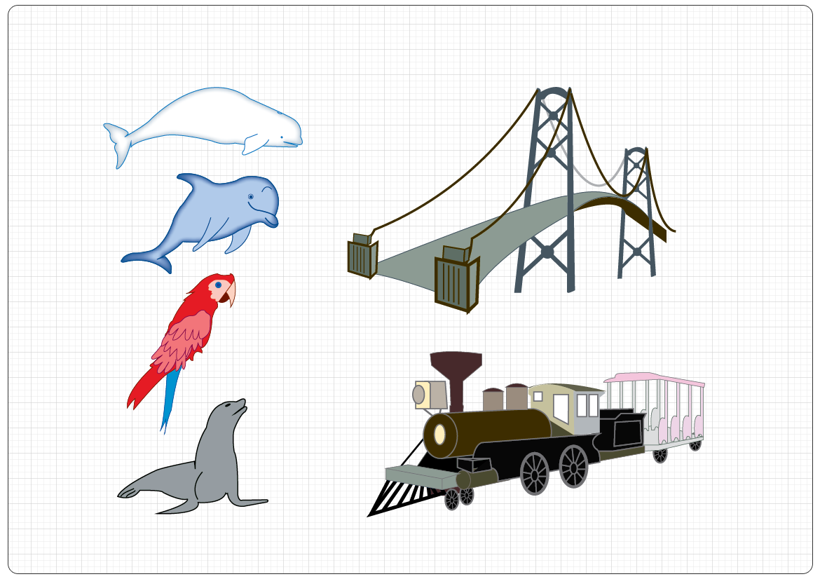
These illustrations were created to highlight the the Vancouver Aquarium and the Stanley Park Railway, but ended up not being used in the final map.
Stanley Park Map - First Outcome and Testing
Below is the first version of the Stanley Park map, based on the research done and after numerous consultations with all parties involved. After the initial round of testing, it became clear that an even simpler version was needed, as users found it too be "too busy", despite finding it much more user-friendly.
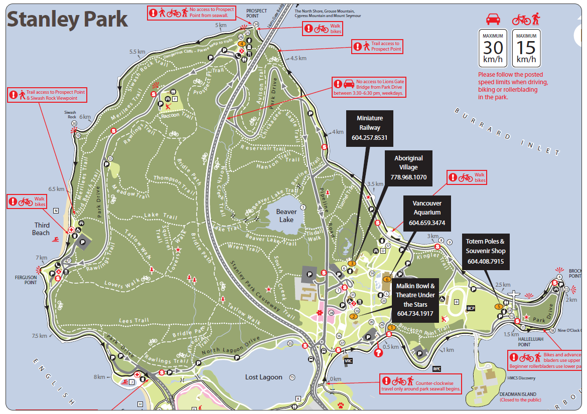
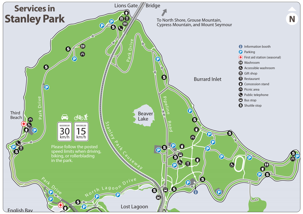
Stanley Park Map - Final Outcome
As we couldn't deviate too much from the look and feel of the original map, the decision was to create a secondary one called Services in Stanley Park, which highlighted just the main roads, the Seawall, the parking areas and other main points of interest (concession stands, bus stops, restaurants, etc.)
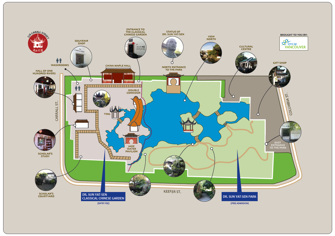
Dr. Sun Yat-Sen Garden and Park Map - Inspiration Board
As with the Stanley Park map, below is a collection of maps used as an inspiration in deciding which direction to go, not only with the Dr. Sun Yat-Sen Park map, but all the consequent ones.
Dr. Sun Yat-Sen Garden and Park Map - Illustrations
These illustrations were created by tracing the original photos I took on the day spent in the garden and park, surveying all the buildings and the lotus pond. They were used in the production of the map.
Dr. Sun Yat-Sen Garden and Park Map - Outcome
As no previous version of the Dr. Sun Yat-Sen Classical Chinese Garden and Park Map existed, this was a very welcomed product, as it provided a clear distinction between the park and the garden, and also pointed out the highlights for each.
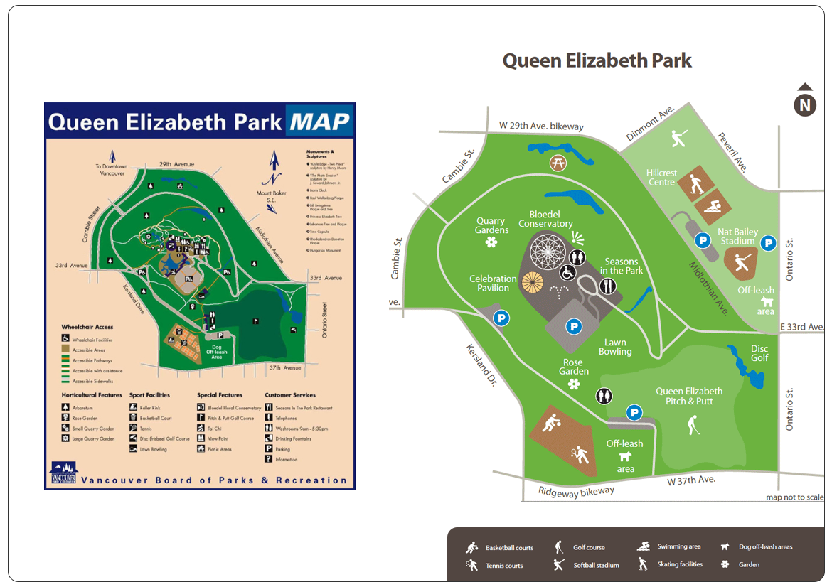
Other examples - Queen Elizabeth Park (before and after)
Showcasing a "before" and "after", the image below shows the transition from an older map style to the new, fresh look and feel - with increased legibility and user-centered design. Note the addition of the Nat Bailey Stadium as part of the Queen Elizabeth Complex.
Showcasing a "before" and "after", the image below shows the transition from an older map style to the new, fresh look and feel - with increased legibility and user-centered design. Note the addition of the Nat Bailey Stadium as part of the Queen Elizabeth Complex.
Testing and Outcome
Our team at the City of Vancouver's Web Redevelopment Project performed one full week of testing in partnership with the Analytic Design Group, based in Gastown. We found that the maps were very well received by all participants.
I personally conducted ethnographic research, by interacting with tourists in Stanley Park and the Seawall or boat and yacht owners in False Creek, to find out how they used the map, how easy it was to find information and what features would they like improved.
In the case of Anchoring in False Creek MAP, almost every marina decided to print out the PDF map I created and display a few versions at each entrance. In asking boat and yacht owners what they thought about the map, the answer was very positive for 3 main reasons:
1) finally there was a map showing clearly the areas where they could drop the anchor and where it was not allowed
2) the map clearly labelled which marinas had pump-outs, anchoring permits and public boat ramps, as well as dingy docks
3) the design was very pleasant, with just enough information that could be absorbed at a glance
Links to maps at vancouver.ca
Stanley Park Map (PDF)
City Hall campus (Interactive)
Queen Elizabeth Park Map (PDF)
Anchoring in False Creek (PDF)
Hastings Park (PDF)